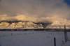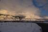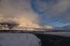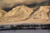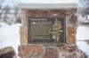
Various photographs I took on February 2, 2017 as I started back out on the road. I went from the Salt Lake City area to Capitol Reef. I mostly traveled south on I-15, and then on Highway 24. I went up over 3,000 feet, and then back down into the Fremont River Valley into Waterpocket Fold. There was snow everywhere when I started. Capitol Reef is a desert area. There was some snow, but not a lot.

dsc_3417_fs_small.jpg mtneboutah_small.jpg dsc_3421_27_affopa_fs_small.jpg dsc_3421_27_affopanat_fs_small.jpg dsc_3421_fs_small.jpg
dsc_3422_fs_small.jpg dsc_3423_fs_small.jpg dsc_3424_fs_small.jpg dsc_3425_fs_small.jpg dsc_3426_fs_small.jpg
dsc_3427_fs_small.jpg dsc_3428_fs_small.jpg dsc_3429_fs_small.jpg dsc_3430_fs_small.jpg dsc_3438_fs_small.jpg
dsc_3441_fs_small.jpg dsc_3442_fs_small.jpg dsc_3444_fs_small.jpg burrastonpondsnearnephiutah_small.jpg dsc_3449_fs_small.jpg
dsc_3451_fs_small.jpg dsc_3452_fs_small.jpg dsc_3453_fs_small.jpg dsc_3454_66affopa_fs_small.jpg dsc_3454_fs_small.jpg
Page:[1] [2] [3] [4] [5]

Photo album created with Web Album Generator